Been a while since I have posted, almost half a year. The year slowly moves on. Here in the Southeast it has been very quiet for the most part but the Plains have been on fire with violent tornadoes sweeping across Oklahoma and other areas. The news event this year will be the loss of a veteran and fellow storm chaser, his son and friend. Tim Samaras, his son Paul and friend Carl Young lost their lives when a 2.6 mile wide monster took an unexpected hard turn north and caught them, people trying to flee the storm and several other chasers by surprise. The interstate was gridlocked as well as secondary roads, no way to escape. The Weather Channel suffered as well as Mike Bettes and his crew where picked up by a tornado in their chase truck and thrown and then rolled across an open field. To many people in one place this time and on top of that a highly populated metro area. Luckily minor injuries for most but one very seriously.
These latest events have brought more attention on chasers and some of it not in a good light. The number of chasers as risen quickly over the years thanks in part television shows chronicling chasers and to the media embracing chasers and using the footage they can provide. Live streams let everyone watch what was going on, just as if they were in the vehicle along for the ride. up close and personal became normal and the footage flowed. After the tragedy of El Reno I was asked to be interviewed by our local Fox and NBC news affiliates. Nothing that I haven't done before over the years but this time it was very different for me.
After the second interview, which was done here at my home, I walked into my house and sat down with my wife. We talked about the interview, if I thought it went well, concerns on how it would come across as it was about storm chasing safety. I finally looked at her and stated "I am the biggest hypocrite and I cant do this anymore." She looked at me and said "What"? My answer was simple. "I have chased for a little over 26 years and have become one of those that brakes the rules". True, little by little pushing the limits and seeing how close it took to get the shot. I had just stood there on tv and told everyone what to do and not to do and yet I never heed my own words on a chase. I have criticized other chasers for their carelessness and recklessness only to do the same thing but in a "different way". My wife had sat there and listened to me and agreed. She began to remind
me I things I did, chances she knew I took and didn't spare me or my
feelings. Sounds harsh but she wasn't mean but compassionate and loving
in the way she did it. As I confessed my "sins" she was there to give
helpful but needed commentary.
There are many rules of chasing and ethics created over the years. If followed they lower the risk as much as it can be lowered. Chasing is never a safe thing but vital information can be gathered by ground truth. But I have become that which I hated. I was caught up in the chase circus of live streams, "chasing for the shot, not the science." I told myself and others that it was for the photography. While true and it was it was going after the photography for the wrong reasons. I continually put myself in harms way and probably others as well. Recent chase with a friend who is a meteorologist at the local Fox affiliate ended up with a funnel passing above us and about 200 yards away and us sitting on the north side of the storm. Breaking a rules yet again I nervously laughed it off as "I knew what I was doing". Yes, doing it wrong and unsafe.
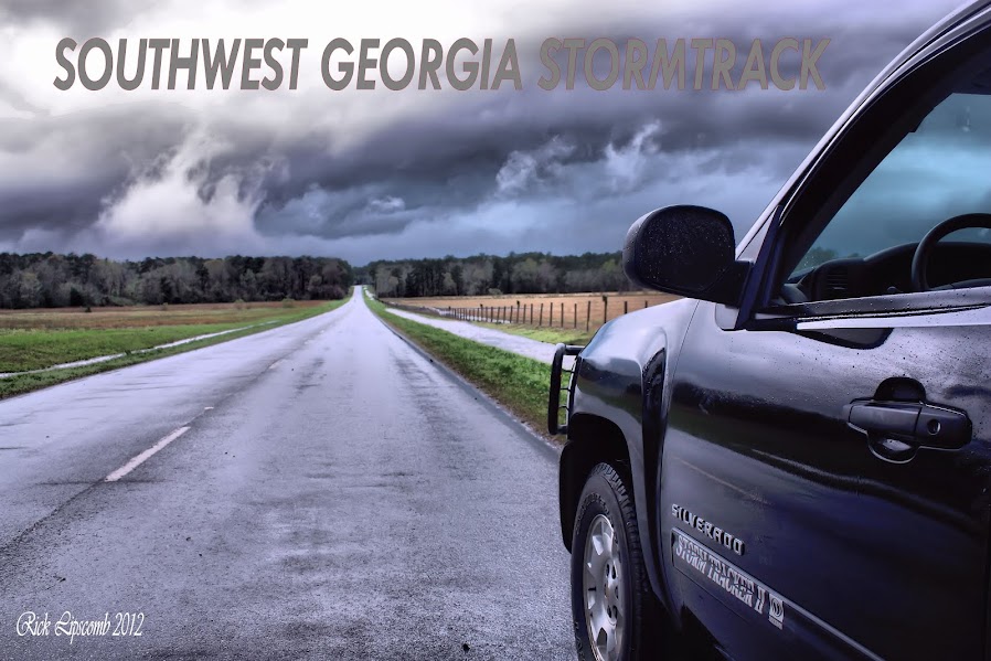
Its easy to sit here and admit to all my deeds done over the last decade and say that I have changed. That will take time. Time to walk the walk, one storm at a time, doing it the right and safe way. Back in 1995 when StormTrackerII was written across the back of my first chase vehicle, it was for the photography. Getting into position, the storm comes to you and getting ground truth for the NWS, snap your pic or video, watch it go along its merry way and wait for the next one. It since had devolved into chasing it down, seeing how close it took to get "the money shot." and repeat process until you lost it. It took the deaths of fellow chasers to wake me up before it was to late for me. Now? We wait and see how the rest of the year goes..
Its still to early to see how this will affect chasers elsewhere, if others will change their approach to chasing or nothing change at all. I can only change the way I do it.....
Time will tell for us all..